 vesseltracker.com
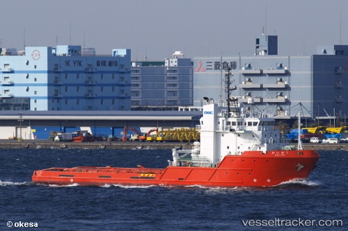
Kaiyu
Current StatusWhere is the vessel?
Kaiyu is currently in Near Yokosuka, based on AIS data received less than 1h ago.
Latest AIS update:
Current position: 35.22173° N, 139.71683° E (Near Yokosuka)
Average speed (last 7 days): Loading…
Average speed (last 30 days): Loading…
Vessel profile: Kaiyu is a Offshore Tug Supply Ship with dimensions 14m x 62m.
This page combines live AIS, route history, probable destination signals, nearby traffic, and port activity for practical vessel monitoring.
The current position of vessel Kaiyu is 35.22173 lat / 139.71683 lng. Updated: 2026-04-16 11:49:20 UTCNearest reference points:
- Near Yokosuka
- Near Naka-Ku, Kanagawa
- 15 nm S of Zushi
Details:
Live Vessel Kaiyu Analytics (details, animations, etc.)
Recent AIS points (UTC):
2026-04-16 06:16:20 UTC · 35.22177, 139.71680 · SOG 0 kn · COG 43°2026-04-16 07:37:18 UTC · 35.22175, 139.71683 · SOG 0 kn · COG 43°
2026-04-16 09:34:20 UTC · 35.22173, 139.71683 · SOG 0 kn · COG 43°
2026-04-16 11:49:20 UTC · 35.22173, 139.71683 · SOG 0 kn · COG 43°