 vesseltracker.com
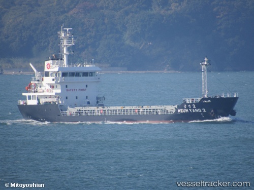
Vessel Keum Yang 2 IMO: 9793313, MMSI: 440711000 General Cargo Ship
UTC, 34.86641, 127.77348, course: 130, speed: 8.3
UTC, 34.78199, 127.80506, course: 169, speed: 8.5
2026-01-16 08:00:24 UTC, 34.77887, 127.80578, course: 163, speed: 8.4
Live AIS position:
UTC. Near Boseong-gun),
updated 2026-01-16 08:00:24 UTC.
Find the position of the vessel Keum Yang 2 on the map. The latter are known coordinates and path.
marine traffic ship tracker show on live map
The current position of vessel Keum Yang 2 is 34.77887 lat / 127.80578 lng. Updated: 2026-01-16 08:00:24 UTCCurrently sailing under the flag of Korea
Details:
Last coordinates of the vessel:
UTC, 34.90776, 127.72021, course: 141, speed: 4.6UTC, 34.86641, 127.77348, course: 130, speed: 8.3
UTC, 34.78199, 127.80506, course: 169, speed: 8.5
2026-01-16 08:00:24 UTC, 34.77887, 127.80578, course: 163, speed: 8.4