 vesseltracker.com
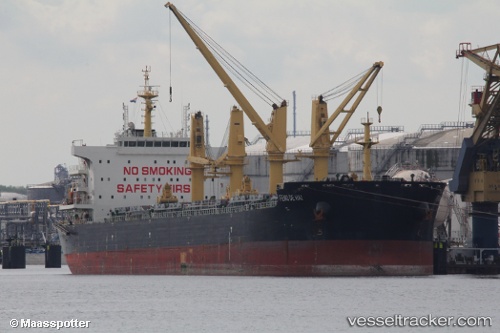
Vessel Feng De Hai IMO: 9727637, MMSI: 477684100 Bulk Carrier
UTC, 33.42177, 29.98424, course: 318, speed: 9.8
UTC, 33.68068, 29.72891, course: 318, speed: 9.6
2026-01-31 11:45:56 UTC, 33.71416, 29.69722, course: 317, speed: 9.3
Live AIS position:
UTC. 143 nm N of Rashid),
updated 2026-01-31 11:45:56 UTC.
Find the position of the vessel Feng De Hai on the map. The latter are known coordinates and path.
marine traffic ship tracker show on live map
The current position of vessel Feng De Hai is 33.71416 lat / 29.69722 lng. Updated: 2026-01-31 11:45:56 UTCDetails:
Last coordinates of the vessel:
UTC, 33.26402, 30.14635, course: 315, speed: 9.8UTC, 33.42177, 29.98424, course: 318, speed: 9.8
UTC, 33.68068, 29.72891, course: 318, speed: 9.6
2026-01-31 11:45:56 UTC, 33.71416, 29.69722, course: 317, speed: 9.3