 vesseltracker.com
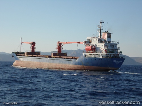
Vessel ABLE IMO: 9001136, MMSI: 511100568 General Cargo Ship
UTC, 36.83633, 35.90341, course: 123, speed: 0
UTC, 36.83640, 35.90336, course: 123, speed: 0
2026-02-07 14:05:47 UTC, 36.83635, 35.90337, course: 123, speed: 0
Live AIS position:
UTC. Near CEYHAN),
updated 2026-02-07 14:05:47 UTC.
Find the position of the vessel ABLE on the map. The latter are known coordinates and path.
marine traffic ship tracker show on live map
The current position of vessel ABLE is 36.83635 lat / 35.90337 lng. Updated: 2026-02-07 14:05:47 UTCCurrently sailing under the flag of Palau (Republic of)
ABLE built in 1991 year
Deadweight:
7416 tDetails:
Last coordinates of the vessel:
UTC, 36.83634, 35.90339, course: 123, speed: 0UTC, 36.83633, 35.90341, course: 123, speed: 0
UTC, 36.83640, 35.90336, course: 123, speed: 0
2026-02-07 14:05:47 UTC, 36.83635, 35.90337, course: 123, speed: 0