 vesseltracker.com
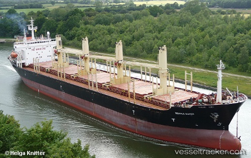
 Peace M
Current Status
Where is the vessel?
Peace M is currently in 20 nm W of Amchit, based on AIS data received about 1h ago.
Latest AIS update:
Current position: 34.20007° N, 35.23103° E (20 nm W of Amchit)
Average speed (last 7 days): Loading…
Average speed (last 30 days): Loading…
Vessel profile: Peace M is a Bulk Carrier with dimensions 168m x 26m.
This page combines live AIS, route history, probable destination signals, nearby traffic, and port activity for practical vessel monitoring.
The current position of vessel Peace M is 34.20007 lat / 35.23103 lng. Updated: 2026-04-02 21:52:45 UTCNearest reference points:
- Near DBAIYEH
- Near Zouk
- Near Tripoli
Currently sailing under the flag of Palau ![]()
Peace M built in 1996 year
Deadweight:
0 tDetails:
Live Vessel Peace M Analytics (details, animations, etc.)
Recent AIS points (UTC):
2026-04-02 15:40:08 UTC · 33.90725, 35.52589 · SOG 0 kn · COG 174°2026-04-02 17:28:21 UTC · 33.90729, 35.52591 · SOG 0 kn · COG 174°
2026-04-02 19:21:56 UTC · 33.95110, 35.49093 · SOG 10.3 kn · COG 272°
2026-04-02 21:52:45 UTC · 34.20007, 35.23103 · SOG 12 kn · COG 10°