 vesseltracker.com
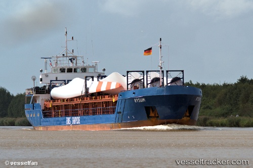
 SEMSA
SEMSA
Current Status
Where is the vessel?
SEMSA is currently in 11 nm NE of Diafánion, based on AIS data received about 1h ago.
Latest AIS update:
Current position: 35.84116° N, 27.41082° E (11 nm NE of Diafánion)
Average speed (last 7 days): Loading…
Average speed (last 30 days): Loading…
Vessel profile: SEMSA is a General Cargo with dimensions m x m.
This page combines live AIS, route history, probable destination signals, nearby traffic, and port activity for practical vessel monitoring.
The current position of vessel SEMSA is 35.84116 lat / 27.41082 lng. Updated: 2026-04-19 11:24:26 UTCNearest reference points:
- Near Datça
- 13 nm E of Nisiros
- 12 nm E of GYALI
Currently sailing under the flag of Palau ![]()
Details:
Live Vessel SEMSA Analytics (details, animations, etc.)
Recent AIS points (UTC):
2026-04-19 07:28:00 UTC · 35.51602, 27.25488 · SOG 6.4 kn · COG 341°2026-04-19 09:50:07 UTC · 35.77291, 27.27099 · SOG 6.3 kn · COG 9°
2026-04-19 10:25:57 UTC · 35.83381, 27.28496 · SOG 6.2 kn · COG 9°
2026-04-19 11:24:26 UTC · 35.84116, 27.41082 · SOG 6.8 kn · COG 91°