 vesseltracker.com
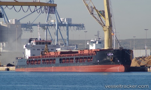
Vessel Leda IMO: 9648178, MMSI: 518559000 General Cargo Ship
UTC, 36.76211, 34.64614, course: -1, speed: 0.1
UTC, 36.76210, 34.64611, course: -1, speed: 0.3
2026-01-28 06:04:48 UTC, 36.76215, 34.64613, course: -1, speed: 0.2
Live AIS position:
UTC. Near Mersin),
updated 2026-01-28 06:04:48 UTC.
Find the position of the vessel Leda on the map. The latter are known coordinates and path.
marine traffic ship tracker show on live map
The current position of vessel Leda is 36.76215 lat / 34.64613 lng. Updated: 2026-01-28 06:04:48 UTCCurrently sailing under the flag of Cook Is
Leda built in 2013 year
Deadweight:
6171 tDetails:
Last coordinates of the vessel:
UTC, 36.76146, 34.64646, course: -1, speed: 0UTC, 36.76211, 34.64614, course: -1, speed: 0.1
UTC, 36.76210, 34.64611, course: -1, speed: 0.3
2026-01-28 06:04:48 UTC, 36.76215, 34.64613, course: -1, speed: 0.2