vessel NEON IMO: 9183295, Crude Oil Tanker vesseltracker.com
Vessel NEON IMO: 9183295, Crude Oil Tanker
MMSI: 518999148 callsign: E5U5129 size: 244x42

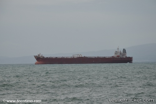
Find the position of the vessel NEON on the map. The latter are known coordinates and path.

marine traffic ship tracker show on live map

The current position of vessel NEON is 38.9103 lat / 26.9519 lng. Updated: 2025-02-12 09:08:17 UTC

Currently sailing under the flag of Cook Is

NEON built in 1999 year

Port of registry:
Valletta (capital of Malta)
Deadweight:
105423 t

Gross tonnage:
57066
Service entry:
1999-01-01T00:00:00Z

Manufacturer:
Hyundai Heavy Industries (South Korean shipbuilding manufacturer)

Details:


Last coordinates of the vessel:
2025-02-12 09:08:17 UTC, 38.9103, 26.9519, course: 64, speed: 0.3

Track of the vessel in the last 14 days


Most frequent ports a vessels calls at NEON (518999148):

Aliaga, traffic: 3
Petkim, traffic: 2
NEMRUT, traffic: 2
Skagens Odde, traffic: 2
Nemrut Bay, traffic: 2
TANGER MED, traffic: 1
Korsor, traffic: 1
SPODSBJERG, traffic: 1
Primorsk, traffic: 1
VISTINO, traffic: 1
Ruch’I, traffic: 1
TARIFA, traffic: 1
Strait Of Gibraltar, traffic: 1
Ust-Luga, traffic: 1

Link to the map:


Find another ship

NEON (518999148) last ports (portcalls and passsages)

NEMRUT | 2025-02-09 18:57:40
Aliaga | 2025-02-08 14:55:42
Aliaga | 2025-02-04 13:23:08
TANGER MED | 2025-01-29 08:22:15
VISTINO | 2025-01-15 08:23:11
Skagens Odde | 2024-12-19 16:40:30
Strait Of Gibraltar | 2024-12-13 17:19:32
NEMRUT | 2024-12-04 11:13:32
Aliaga | 2024-12-03 09:12:25
SPODSBJERG | 2024-11-18 01:05:22
Primorsk | 2024-11-13 12:52:30
Korsor | 2024-11-08 06:54:40
Skagens Odde | 2024-11-07 16:57:56