 vesseltracker.com
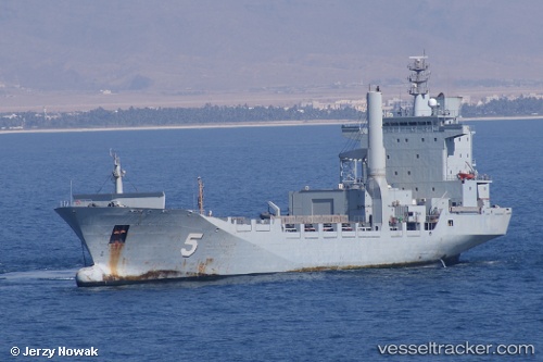
 Ka Bunga Mas 5
Current Status
Where is the vessel?
Ka Bunga Mas 5 is currently in Near Kota Kinabalu, based on AIS data received less than 1h ago.
Latest AIS update:
Current position: 6.08570° N, 116.11422° E (Near Kota Kinabalu)
Average speed (last 7 days): Loading…
Average speed (last 30 days): Loading…
Vessel profile: Ka Bunga Mas 5 is a Service Ship with dimensions 133m x 133m.
This page combines live AIS, route history, probable destination signals, nearby traffic, and port activity for practical vessel monitoring.
The current position of vessel Ka Bunga Mas 5 is 6.08570 lat / 116.11422 lng. Updated: 2026-04-07 05:42:32 UTCNearest reference points:
- Near Kota Kinabalu
- 44 nm SW of Tembungo
- Near Kikeh
Currently sailing under the flag of Malaysia ![]()
Ka Bunga Mas 5 built in 1997 year
Deadweight:
8991 tDetails:
Live Vessel Ka Bunga Mas 5 Analytics (details, animations, etc.)
Recent AIS points (UTC):
2026-04-07 00:27:42 UTC · 6.08570, 116.11417 · SOG 0.1 kn · COG -1°2026-04-07 02:18:53 UTC · 6.08568, 116.11422 · SOG 0 kn · COG -1°
2026-04-07 04:10:22 UTC · 6.08570, 116.11421 · SOG 0.1 kn · COG -1°
2026-04-07 05:42:32 UTC · 6.08570, 116.11422 · SOG 0.1 kn · COG -1°