 vesseltracker.com
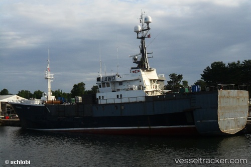
 Tromsbas
Current Status
Where is the vessel?
Tromsbas is currently in Near Tromso, based on AIS data received about 1h ago.
Latest AIS update:
Current position: 69.64642° N, 18.98048° E (Near Tromso)
Average speed (last 7 days): Loading…
Average speed (last 30 days): Loading…
Vessel profile: Tromsbas is a Fish Carrier with dimensions 68m x 68m.
This page combines live AIS, route history, probable destination signals, nearby traffic, and port activity for practical vessel monitoring.
The current position of vessel Tromsbas is 69.64642 lat / 18.98048 lng. Updated: 2026-04-07 12:04:42 UTCNearest reference points:
- Near Tromso
- Near Tromsø
- Near SOMMAROY
Currently sailing under the flag of Norway ![]()
Tromsbas built in 1956 year
Details:
Live Vessel Tromsbas Analytics (details, animations, etc.)
Recent AIS points (UTC):
2026-04-07 06:16:42 UTC · 69.64641, 18.98045 · SOG 0 kn · COG 351°2026-04-07 07:27:30 UTC · 69.64639, 18.98047 · SOG 0 kn · COG 353°
2026-04-07 10:24:19 UTC · 69.64643, 18.98044 · SOG 0 kn · COG 350°
2026-04-07 12:04:42 UTC · 69.64642, 18.98048 · SOG 0 kn · COG 350°