 vesseltracker.com
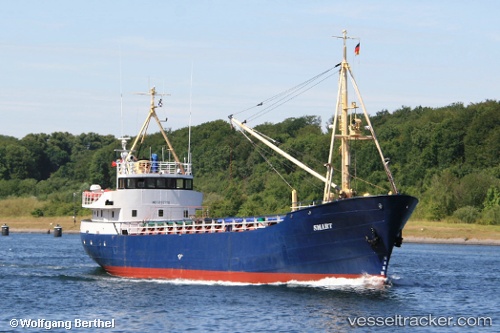
 SMART
SMART
Current Status
Where is the vessel?
SMART is currently in 52 nm SE of Lince, based on AIS data received about 2h ago.
Latest AIS update:
Current position: 11.41628° N, 76.50538° W (52 nm SE of Lince)
Average speed (last 7 days): Loading…
Average speed (last 30 days): Loading…
Vessel profile: SMART is a General Cargo Ship with dimensions 8m x 49m.
This page combines live AIS, route history, probable destination signals, nearby traffic, and port activity for practical vessel monitoring.
The current position of vessel SMART is 11.41628 lat / -76.50538 lng. Updated: 2026-04-13 01:58:54 UTCNearest reference points:
- Near Sociedad Portuaria Regional Cartagena
- Near Contecar
- 62 nm NE of Playón Chico
Currently sailing under the flag of Colombia ![]()
SMART built in 1960 year
Deadweight:
640 tDetails:
Live Vessel SMART Analytics (details, animations, etc.)
Recent AIS points (UTC):
2026-04-12 20:47:31 UTC · 11.28767, -75.82613 · SOG 8.3 kn · COG 224°2026-04-12 22:37:37 UTC · 11.33393, -76.05445 · SOG 7.9 kn · COG -1°
2026-04-13 01:33:06 UTC · 11.40652, -76.44886 · SOG 7.8 kn · COG 217°
2026-04-13 01:58:54 UTC · 11.41628, -76.50538 · SOG 8.1 kn · COG 226°