 vesseltracker.com
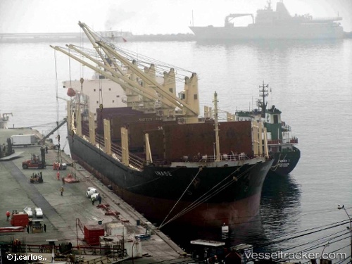
Vessel Inase IMO: 9445148, MMSI: 538003298 Bulk Carrier
UTC, 44.36731, 29.89466, course: 28, speed: 12.1
UTC, 44.71288, 30.18999, course: 37, speed: 12.2
2026-01-29 08:15:25 UTC, 44.90025, 30.32088, course: 218, speed: 0.6
Live AIS position:
UTC. 32 nm SE of Sulina (Port et Zone Franche)),
updated 2026-01-29 08:15:25 UTC.
Find the position of the vessel Inase on the map. The latter are known coordinates and path.
marine traffic ship tracker show on live map
The current position of vessel Inase is 44.90025 lat / 30.32088 lng. Updated: 2026-01-29 08:15:25 UTCDetails:
Last coordinates of the vessel:
UTC, 43.79308, 29.68787, course: 6, speed: 11.9UTC, 44.36731, 29.89466, course: 28, speed: 12.1
UTC, 44.71288, 30.18999, course: 37, speed: 12.2
2026-01-29 08:15:25 UTC, 44.90025, 30.32088, course: 218, speed: 0.6