 vesseltracker.com
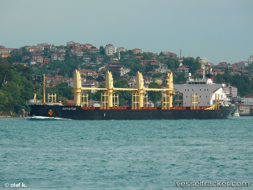
Amyntor
Current StatusWhere is the vessel?
Amyntor is currently in 23 nm W of Halul Island, based on AIS data received less than 1h ago.
Latest AIS update:
Current position: 25.74150° N, 52.03153° E (23 nm W of Halul Island)
Average speed (last 7 days): Loading…
Average speed (last 30 days): Loading…
Vessel profile: Amyntor is a Bulk Carrier with dimensions 27m x 169m.
This page combines live AIS, route history, probable destination signals, nearby traffic, and port activity for practical vessel monitoring.
The current position of vessel Amyntor is 25.74150 lat / 52.03153 lng. Updated: 2026-04-10 06:03:14 UTCNearest reference points:
- Near RAS LAFFAN
- 21 nm NE of Halul Island
- Near Das Island
Details:
Live Vessel Amyntor Analytics (details, animations, etc.)
Recent AIS points (UTC):
2026-04-09 23:41:11 UTC · 25.74190, 52.03222 · SOG 0.2 kn · COG 134°2026-04-10 02:28:07 UTC · 25.74233, 52.03388 · SOG 0.1 kn · COG 227°
2026-04-10 03:55:21 UTC · 25.74227, 52.03183 · SOG 0.3 kn · COG -1°
2026-04-10 06:03:14 UTC · 25.74150, 52.03153 · SOG 0.4 kn · COG -1°