 vesseltracker.com
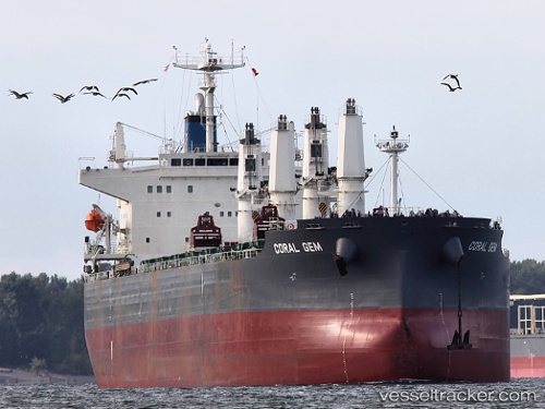
Coral Gem
Current StatusWhere is the vessel?
Coral Gem is currently in 238 nm NW of Tinaquillo, based on AIS data received about 3h ago.
Latest AIS update:
Current position: 12.84500° N, 65.56333° E (238 nm NW of Tinaquillo)
Average speed (last 7 days): Loading…
Average speed (last 30 days): Loading…
Vessel profile: Coral Gem is a Bulk Carrier with dimensions 32m x 190m.
This page combines live AIS, route history, probable destination signals, nearby traffic, and port activity for practical vessel monitoring.
The current position of vessel Coral Gem is 12.84500 lat / 65.56333 lng. Updated: 2026-04-08 15:51:57 UTCNearest reference points:
- 187 nm N of Tinaquillo
- Open sea, approx. 403 nm off the nearest listed port
- Open sea, approx. 406 nm off the nearest listed port
Details:
Live Vessel Coral Gem Analytics (details, animations, etc.)
Recent AIS points (UTC):
2026-04-08 11:57:57 UTC · 12.22333, 65.39833 · SOG 9 kn · COG -1°2026-04-08 14:21:50 UTC · 12.60667, 65.49833 · SOG 9 kn · COG -1°
2026-04-08 14:27:50 UTC · 12.62167, 65.50333 · SOG 9 kn · COG -1°
2026-04-08 15:51:57 UTC · 12.84500, 65.56333 · SOG 9 kn · COG -1°