 vesseltracker.com
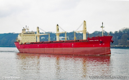
 FEDERAL MAYUMI
Current Status
Where is the vessel?
FEDERAL MAYUMI is currently in 48 nm SW of Saint-Pierre, based on AIS data received less than 1h ago.
Latest AIS update:
Current position: 46.23229° N, 57.02436° W (48 nm SW of Saint-Pierre)
Average speed (last 7 days): Loading…
Average speed (last 30 days): Loading…
Vessel profile: FEDERAL MAYUMI is a Bulk Carrier with dimensions 200m x 200m.
This page combines live AIS, route history, probable destination signals, nearby traffic, and port activity for practical vessel monitoring.
The current position of vessel FEDERAL MAYUMI is 46.23229 lat / -57.02436 lng. Updated: 2026-03-29 21:26:43 UTCNearest reference points:
- Near SAINT PIERRE
- Near MIQUELON
- Near Fortune
Currently sailing under the flag of Marshall Islands ![]()
FEDERAL MAYUMI built in 2012 year
Deadweight:
35300 tDetails:
Live Vessel FEDERAL MAYUMI Analytics (details, animations, etc.)
Recent AIS points (UTC):
2026-03-29 15:22:26 UTC · 46.27351, -58.86060 · SOG 12.1 kn · COG -1°2026-03-29 17:21:25 UTC · 46.25370, -58.27972 · SOG 12.5 kn · COG 94°
2026-03-29 19:33:15 UTC · 46.24410, -57.62929 · SOG 13.4 kn · COG 92°
2026-03-29 21:26:43 UTC · 46.23229, -57.02436 · SOG 13.3 kn · COG 90°