 vesseltracker.com
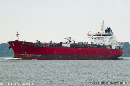
Vessel Sti Hammersmith IMO: 9706463, MMSI: 538005410 Chemical Oil Products Tanker
UTC, 31.16343, 29.85499, course: 330, speed: 0
UTC, 31.16347, 29.85501, course: 330, speed: 0
2026-01-28 15:24:14 UTC, 31.16341, 29.85498, course: 330, speed: 0
Live AIS position:
UTC. Near Alexandria),
updated 2026-01-28 15:24:14 UTC.
Find the position of the vessel Sti Hammersmith on the map. The latter are known coordinates and path.
marine traffic ship tracker show on live map
The current position of vessel Sti Hammersmith is 31.16341 lat / 29.85498 lng. Updated: 2026-01-28 15:24:14 UTCDetails:
Last coordinates of the vessel:
UTC, 31.16341, 29.85498, course: 330, speed: 0UTC, 31.16343, 29.85499, course: 330, speed: 0
UTC, 31.16347, 29.85501, course: 330, speed: 0
2026-01-28 15:24:14 UTC, 31.16341, 29.85498, course: 330, speed: 0