 vesseltracker.com
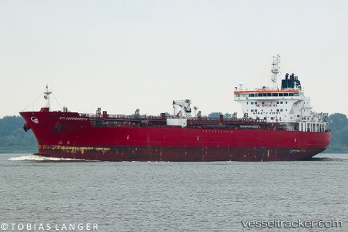
Find the position of the vessel Sti Hammersmith on the map. The latter are known coordinates and path.
marine traffic ship tracker show on live map
The current position of vessel Sti Hammersmith is 49.4795 lat / 0.18373 lng. Updated: 2024-04-29 11:52:19 UTCPort of registry:
Majuro (coral atoll, capital of the Marshall Islands)Speed:
15 knotPayload_mass:
38734 tonneGross tonnage:
24162Service entry:
2015-01-01T00:00:00ZManufacturer:
Hyundai Mipo Dockyard (South Korean shipbuilding company)Details:
Last coordinates of the vessel:
UTC, 49.4794, 0.183748, course: 139, speed: 0UTC, 49.4794, 0.183788, course: 139, speed: 0
UTC, 49.4794, 0.183783, course: 139, speed: 0
2024-04-29 11:52:19 UTC, 49.4795, 0.18373, course: 139, speed: 0