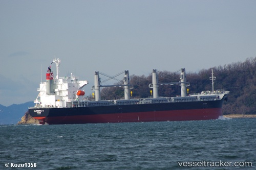
Gardenia K
Current StatusWhere is the vessel?
Gardenia K is currently in Near SHINMONJI, based on AIS data received about 14h ago.
Latest AIS update:
Current position: 33.92736° N, 131.08588° E (Near SHINMONJI)
Average speed (last 7 days): Loading…
Average speed (last 30 days): Loading…
Vessel profile: Gardenia K is a Bulk Carrier with dimensions 30m x 180m.
This page combines live AIS, route history, probable destination signals, nearby traffic, and port activity for practical vessel monitoring.
The current position of vessel Gardenia K is 33.92736 lat / 131.08588 lng. Updated: 2026-05-24 21:39:04 UTCNearest reference points:
- Near Ube
- Near Shimonoseki
- Near KANDA
Details:
Live Vessel Gardenia K Analytics (details, animations, etc.)
Recent AIS points (UTC):
2026-05-24 17:52:23 UTC · 33.63148, 131.80168 · SOG 11.7 kn · COG 331°2026-05-24 19:44:22 UTC · 33.81513, 131.47571 · SOG 11.7 kn · COG 282°
2026-05-24 19:47:22 UTC · 33.81719, 131.46428 · SOG 11.7 kn · COG 282°
2026-05-24 21:39:04 UTC · 33.92736, 131.08588 · SOG 6.3 kn · COG 304°