 vesseltracker.com
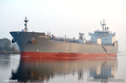
Find the position of the vessel Eco Fleet on the map. The latter are known coordinates and path.
marine traffic ship tracker show on live map
The current position of vessel Eco Fleet is 40.7173 lat / 29.4721 lng. Updated: 2025-06-14 09:39:49 UTCCurrently sailing under the flag of Marshall Is
Port of registry:
Majuro (capital of the Marshall Islands)Payload_mass:
39135 tonneGross tonnage:
24061Beam:
28 metreService entry:
2015-01-01T00:00:00ZManufacturer:
HD Hyundai Vietnam Shipbuilding (Vietnamese shipbuilding company)Details:
Last coordinates of the vessel:
2025-06-14 09:39:49 UTC, 40.7173, 29.4721, course: 308, speed: 0