 vesseltracker.com
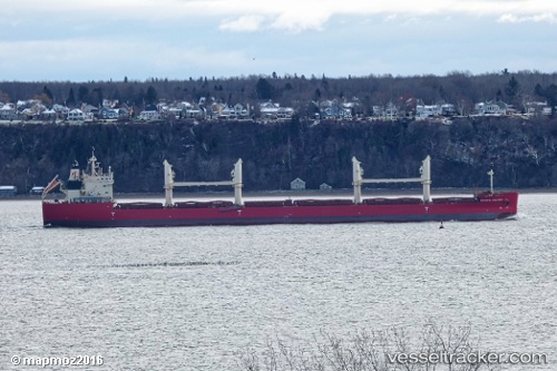
Vessel Federal Columbia IMO: 9671084, MMSI: 538006471 Bulk Carrier
UTC, 51.31079, 3.83385, course: 65, speed: 0
UTC, 51.31081, 3.83385, course: 65, speed: 0
2026-03-14 15:29:12 UTC, 51.31079, 3.83381, course: 65, speed: 0
Live Vessel Federal Columbia Analytics (details, animations, etc.)
Live AIS position: UTC. Near Terneuzen), updated 2026-03-14 15:29:12 UTC.Find the position of the vessel Federal Columbia on the map. The latter are known coordinates and path.
marine traffic ship tracker show on live map
The current position of vessel Federal Columbia is 51.31079 lat / 3.83381 lng. Updated: 2026-03-14 15:29:12 UTCCurrently sailing under the flag of Marshall Is
Details:
Last coordinates of the vessel:
UTC, 51.31081, 3.83382, course: 65, speed: 0.1UTC, 51.31079, 3.83385, course: 65, speed: 0
UTC, 51.31081, 3.83385, course: 65, speed: 0
2026-03-14 15:29:12 UTC, 51.31079, 3.83381, course: 65, speed: 0