 vesseltracker.com
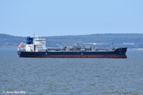
Palanca Rio
Current StatusWhere is the vessel?
Palanca Rio is currently in Near Courtenay Bay, based on AIS data received less than 1h ago.
Latest AIS update:
Current position: 45.27378° N, 66.03965° W (Near Courtenay Bay)
Average speed (last 7 days): Loading…
Average speed (last 30 days): Loading…
Vessel profile: Palanca Rio is a Bitumen Tanker with dimensions 23m x 133m.
This page combines live AIS, route history, probable destination signals, nearby traffic, and port activity for practical vessel monitoring.
The current position of vessel Palanca Rio is 45.27378 lat / -66.03965 lng. Updated: 2026-04-19 12:15:41 UTCNearest reference points:
- Near St. John
- Near Tiverton
- 16 nm W of Tiverton
Details:
Live Vessel Palanca Rio Analytics (details, animations, etc.)
Recent AIS points (UTC):
2026-04-19 08:28:05 UTC · 45.27380, -66.03961 · SOG 0 kn · COG -1°2026-04-19 09:24:41 UTC · 45.27380, -66.03963 · SOG 0 kn · COG 180°
2026-04-19 10:45:42 UTC · 45.27380, -66.03965 · SOG 0 kn · COG 179°
2026-04-19 12:15:41 UTC · 45.27378, -66.03965 · SOG 0 kn · COG 179°