 vesseltracker.com
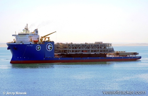
Gpo Grace
Current StatusWhere is the vessel?
Gpo Grace is currently in Near Nieuwdorp, based on AIS data received less than 1h ago.
Latest AIS update:
Current position: 51.44542° N, 3.70764° E (Near Nieuwdorp)
Average speed (last 7 days): Loading…
Average speed (last 30 days): Loading…
Vessel profile: Gpo Grace is a Heavy Load Carrier with dimensions 48m x 225m.
This page combines live AIS, route history, probable destination signals, nearby traffic, and port activity for practical vessel monitoring.
The current position of vessel Gpo Grace is 51.44542 lat / 3.70764 lng. Updated: 2026-04-22 14:05:45 UTCNearest reference points:
- Near Nieuwdorp
- Near Borssele
- Near BASTIAAN DE LANGEPLA
Details:
Live Vessel Gpo Grace Analytics (details, animations, etc.)
Recent AIS points (UTC):
2026-04-22 10:41:40 UTC · 51.44541, 3.70763 · SOG 0 kn · COG 42°2026-04-22 12:20:39 UTC · 51.44542, 3.70763 · SOG 0 kn · COG 41°
2026-04-22 13:37:04 UTC · 51.44541, 3.70763 · SOG 0 kn · COG -1°
2026-04-22 14:05:45 UTC · 51.44542, 3.70764 · SOG 0 kn · COG 42°