 vesseltracker.com
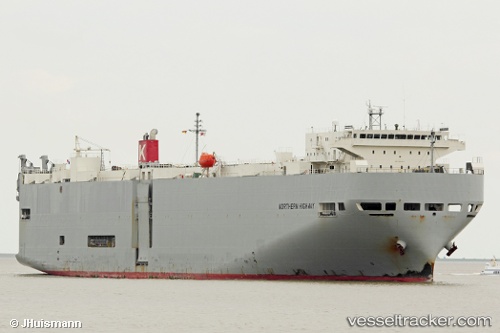
Northern Highway
Current StatusWhere is the vessel?
Northern Highway is currently in 58 nm SW of Kendawangan, based on AIS data received about 7h ago.
Latest AIS update:
Current position: 3.27808° S, 109.59630° E (58 nm SW of Kendawangan)
Average speed (last 7 days): Loading…
Average speed (last 30 days): Loading…
Vessel profile: Northern Highway is a Vehicles Carrier with dimensions 28m x 188m.
This page combines live AIS, route history, probable destination signals, nearby traffic, and port activity for practical vessel monitoring.
The current position of vessel Northern Highway is -3.27808 lat / 109.59630 lng. Updated: 2026-04-05 03:26:42 UTCNearest reference points:
- 45 nm SW of Kendawangan
- 39 nm NW of Kendawangan
- 20 nm N of Kendawangan
Details:
Live Vessel Northern Highway Analytics (details, animations, etc.)
Recent AIS points (UTC):
2026-04-04 20:10:52 UTC · -4.54697, 110.68355 · SOG 15.4 kn · COG 294°2026-04-05 00:44:35 UTC · -3.93558, 109.71230 · SOG 15.4 kn · COG 320°
2026-04-05 02:40:49 UTC · -3.47005, 109.60375 · SOG 15 kn · COG 1°
2026-04-05 03:26:42 UTC · -3.27808, 109.59630 · SOG 14.9 kn · COG 359°