 vesseltracker.com
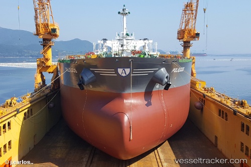
Vessel Poliegos IMO: 9746621, MMSI: 538007797 Crude Oil Tanker
UTC, 37.72700, 24.07395, course: 17, speed: 0.5
UTC, 37.72682, 24.07421, course: 340, speed: 0.6
2026-03-10 07:57:27 UTC, 37.72704, 24.07290, course: -1, speed: 0.7
Live Vessel Poliegos Analytics (details, animations, etc.)
Live AIS position: UTC. Near Laurium (Lavrion)), updated 2026-03-10 07:57:27 UTC.Find the position of the vessel Poliegos on the map. The latter are known coordinates and path.
marine traffic ship tracker show on live map
The current position of vessel Poliegos is 37.72704 lat / 24.07290 lng. Updated: 2026-03-10 07:57:27 UTCCurrently sailing under the flag of Marshall Is
Details:
Last coordinates of the vessel:
UTC, 37.72703, 24.07342, course: 29, speed: 0.7UTC, 37.72700, 24.07395, course: 17, speed: 0.5
UTC, 37.72682, 24.07421, course: 340, speed: 0.6
2026-03-10 07:57:27 UTC, 37.72704, 24.07290, course: -1, speed: 0.7