 vesseltracker.com
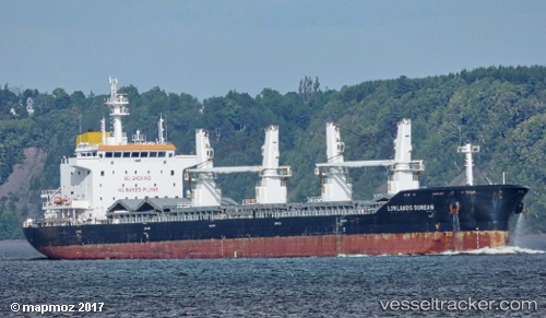
Vessel Federal Yamaska IMO: 9609665, MMSI: 538008088 Bulk Carrier
UTC, 45.53791, -73.53774, course: 213, speed: 0
UTC, 45.53792, -73.53773, course: 213, speed: 0
2026-03-13 05:54:03 UTC, 45.53792, -73.53774, course: 213, speed: 0
Live Vessel Federal Yamaska Analytics (details, animations, etc.)
Live AIS position: UTC. Near Longueuil), updated 2026-03-13 05:54:03 UTC.Find the position of the vessel Federal Yamaska on the map. The latter are known coordinates and path.
marine traffic ship tracker show on live map
The current position of vessel Federal Yamaska is 45.53792 lat / -73.53774 lng. Updated: 2026-03-13 05:54:03 UTCCurrently sailing under the flag of Marshall Is
Details:
Last coordinates of the vessel:
UTC, 45.53792, -73.53775, course: 213, speed: 0UTC, 45.53791, -73.53774, course: 213, speed: 0
UTC, 45.53792, -73.53773, course: 213, speed: 0
2026-03-13 05:54:03 UTC, 45.53792, -73.53774, course: 213, speed: 0