 vesseltracker.com
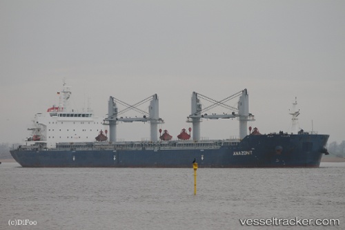
Vessel MINOAS IMO: 9519315, MMSI: 538009011 Bulk Carrier
UTC, 54.66818, 19.78601, course: -1, speed: 0
UTC, 54.66752, 19.78817, course: -1, speed: 0.1
2026-03-03 19:18:27 UTC, 54.66719, 19.78863, course: -1, speed: 0.1
Live AIS position:
UTC. Near Baltiysk),
updated 2026-03-03 19:18:27 UTC.
Find the position of the vessel MINOAS on the map. The latter are known coordinates and path.
marine traffic ship tracker show on live map
The current position of vessel MINOAS is 54.66719 lat / 19.78863 lng. Updated: 2026-03-03 19:18:27 UTCCurrently sailing under the flag of Marshall Islands
MINOAS built in 2011 year
Deadweight:
56952 tDetails:
Last coordinates of the vessel:
UTC, 54.77228, 19.49140, course: -1, speed: 12.5UTC, 54.66818, 19.78601, course: -1, speed: 0
UTC, 54.66752, 19.78817, course: -1, speed: 0.1
2026-03-03 19:18:27 UTC, 54.66719, 19.78863, course: -1, speed: 0.1