 vesseltracker.com
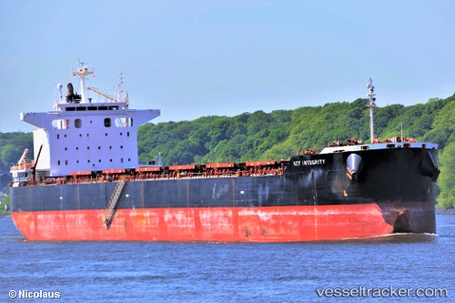
 MAGIC THUNDER
Current Status
Where is the vessel?
MAGIC THUNDER is currently in 269 nm W of Stybarrow Venture MV17, based on AIS data received less than 1h ago.
Latest AIS update:
Current position: 21.83833° S, 109.01333° E (269 nm W of Stybarrow Venture MV17)
Average speed (last 7 days): Loading…
Average speed (last 30 days): Loading…
Vessel profile: MAGIC THUNDER is a Bulk Carrier with dimensions 229m x 229m.
This page combines live AIS, route history, probable destination signals, nearby traffic, and port activity for practical vessel monitoring.
The current position of vessel MAGIC THUNDER is -21.83833 lat / 109.01333 lng. Updated: 2026-03-29 09:41:51 UTCNearest reference points:
- Open sea (no nearby ports in database)
- Open sea, approx. 407 nm off the nearest listed port
Currently sailing under the flag of Marshall Islands ![]()
MAGIC THUNDER built in 2011 year
Deadweight:
83375 tDetails:
Live Vessel MAGIC THUNDER Analytics (details, animations, etc.)
Recent AIS points (UTC):
2026-03-29 03:35:49 UTC · -22.98333, 109.33167 · SOG 11 kn · COG -1°2026-03-29 05:44:52 UTC · -22.58667, 109.21500 · SOG 11 kn · COG -1°
2026-03-29 07:44:12 UTC · -22.20803, 109.11639 · SOG 11.6 kn · COG 345°
2026-03-29 09:41:51 UTC · -21.83833, 109.01333 · SOG 11 kn · COG -1°