 vesseltracker.com
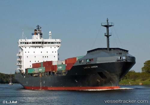
Vessel MORAGA IMO: 9220067, MMSI: 538009489 Container Ship
UTC, 44.15178, 28.64788, course: -1, speed: 0
UTC, 44.02782, 28.76090, course: -1, speed: 9.1
2026-03-06 03:47:12 UTC, 43.78262, 28.78976, course: -1, speed: 9.5
Live Vessel MORAGA Analytics (details, animations, etc.)
Live AIS position: UTC. Near MANGALIA), updated 2026-03-06 03:47:12 UTC.Find the position of the vessel MORAGA on the map. The latter are known coordinates and path.
marine traffic ship tracker show on live map
The current position of vessel MORAGA is 43.78262 lat / 28.78976 lng. Updated: 2026-03-06 03:47:12 UTCCurrently sailing under the flag of Marshall Islands
MORAGA built in 2001 year
Deadweight:
14901 tDetails:
Last coordinates of the vessel:
UTC, 44.15180, 28.64789, course: -1, speed: 0UTC, 44.15178, 28.64788, course: -1, speed: 0
UTC, 44.02782, 28.76090, course: -1, speed: 9.1
2026-03-06 03:47:12 UTC, 43.78262, 28.78976, course: -1, speed: 9.5