 vesseltracker.com
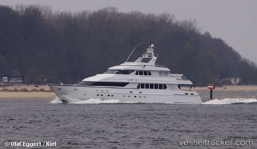
Vessel Lady M I I IMO: 1004819, MMSI: 538070743 Service Ship
UTC, 18.03836, -63.09473, course: 40, speed: 0
UTC, 18.03832, -63.09476, course: 40, speed: 0
2026-01-28 04:31:57 UTC, 18.03832, -63.09472, course: 41, speed: 0
Live AIS position:
UTC. Near ST MAARTEN),
updated 2026-01-28 04:31:57 UTC.
Find the position of the vessel Lady M I I on the map. The latter are known coordinates and path.
marine traffic ship tracker show on live map
The current position of vessel Lady M I I is 18.03832 lat / -63.09472 lng. Updated: 2026-01-28 04:31:57 UTCCurrently sailing under the flag of Marshall Is
Lady M I I built in 1994 year
Details:
Last coordinates of the vessel:
UTC, 18.03834, -63.09474, course: 41, speed: 0UTC, 18.03836, -63.09473, course: 40, speed: 0
UTC, 18.03832, -63.09476, course: 40, speed: 0
2026-01-28 04:31:57 UTC, 18.03832, -63.09472, course: 41, speed: 0