 vesseltracker.com
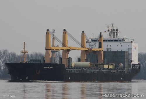
 LILAC ROLLER
Current Status
Where is the vessel?
LILAC ROLLER is currently in Open sea, approx. 527 nm off the nearest listed port, based on AIS data received about 1d ago.
Latest AIS update:
Current position: 5.91137° S, 6.53284° W (Open sea, approx. 527 nm off the nearest listed port)
Average speed (last 7 days): Loading…
Average speed (last 30 days): Loading…
Vessel profile: LILAC ROLLER is a General Cargo with dimensions m x m.
This page combines live AIS, route history, probable destination signals, nearby traffic, and port activity for practical vessel monitoring.
The current position of vessel LILAC ROLLER is -5.91137 lat / -6.53284 lng. Updated: 2026-04-10 07:31:20 UTCNearest reference points:
- Open sea, approx. 527 nm off the nearest listed port
- Open sea, approx. 532 nm off the nearest listed port
- Open sea, approx. 520 nm off the nearest listed port
Currently sailing under the flag of Marshall Islands ![]()
Details:
Live Vessel LILAC ROLLER Analytics (details, animations, etc.)
Recent AIS points (UTC):
2026-04-10 02:36:26 UTC · -6.81985, -5.77876 · SOG 14.3 kn · COG 320°2026-04-10 04:17:54 UTC · -6.50663, -6.04132 · SOG 14.1 kn · COG 321°
2026-04-10 05:21:23 UTC · -6.31318, -6.20481 · SOG 14.3 kn · COG 323°
2026-04-10 07:31:20 UTC · -5.91137, -6.53284 · SOG 14.3 kn · COG 321°