 vesseltracker.com
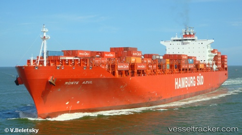
Monte Azul
Current StatusWhere is the vessel?
Monte Azul is currently in Near Rio Grande, based on AIS data received less than 1h ago.
Latest AIS update:
Current position: 32.12848° S, 52.10258° W (Near Rio Grande)
Average speed (last 7 days): Loading…
Average speed (last 30 days): Loading…
Vessel profile: Monte Azul is a Container Ship with dimensions 40m x 272m.
This page combines live AIS, route history, probable destination signals, nearby traffic, and port activity for practical vessel monitoring.
The current position of vessel Monte Azul is -32.12848 lat / -52.10258 lng. Updated: 2026-04-15 06:03:25 UTCNearest reference points:
- Near Rio Grande
- 24 nm SE of São José do Norte
- 55 nm SE of Chui
Details:
Live Vessel Monte Azul Analytics (details, animations, etc.)
Recent AIS points (UTC):
2026-04-14 23:20:30 UTC · -32.12832, -52.10233 · SOG 0 kn · COG 4°2026-04-15 01:26:29 UTC · -32.12830, -52.10240 · SOG 0 kn · COG 4°
2026-04-15 04:17:30 UTC · -32.12833, -52.10235 · SOG 0 kn · COG 4°
2026-04-15 06:03:25 UTC · -32.12848, -52.10258 · SOG 0 kn · COG 4°