 vesseltracker.com
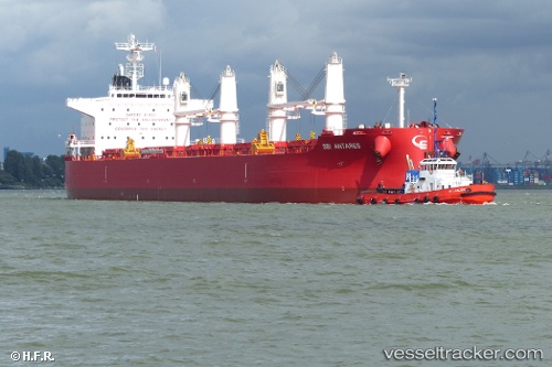
 NOOTKA ISLAND
Current Status
Where is the vessel?
NOOTKA ISLAND is currently in 37 nm SW of Benijofar, based on AIS data received about 1h ago.
Latest AIS update:
Current position: 37.61677° N, 0.21312° E (37 nm SW of Benijofar)
Average speed (last 7 days): Loading…
Average speed (last 30 days): Loading…
Vessel profile: NOOTKA ISLAND is a Cargo with dimensions m x m.
This page combines live AIS, route history, probable destination signals, nearby traffic, and port activity for practical vessel monitoring.
The current position of vessel NOOTKA ISLAND is 37.61677 lat / 0.21312 lng. Updated: 2026-04-08 19:23:48 UTCNearest reference points:
- Near Torre Horadada
- 50 nm N of Mostaganem
- Near Villajoyosa
Currently sailing under the flag of Singapore ![]()
Details:
Live Vessel NOOTKA ISLAND Analytics (details, animations, etc.)
Recent AIS points (UTC):
2026-04-08 13:59:58 UTC · 37.65105, 0.38976 · SOG 1.5 kn · COG 303°2026-04-08 16:14:18 UTC · 37.63513, 0.31546 · SOG 1.4 kn · COG 308°
2026-04-08 17:41:38 UTC · 37.62763, 0.26994 · SOG 1.5 kn · COG 312°
2026-04-08 19:23:48 UTC · 37.61677, 0.21312 · SOG 1.7 kn · COG 320°