 vesseltracker.com
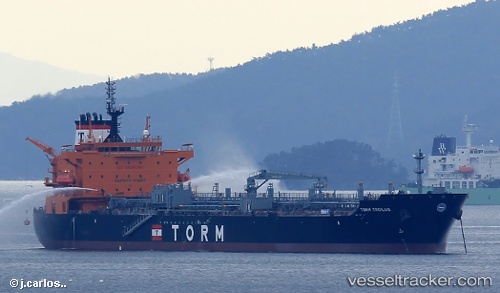
 Torm Troilus
Current Status
Where is the vessel?
Torm Troilus is currently in 16 nm SE of Port Bolivar, based on AIS data received about 1h ago.
Latest AIS update:
Current position: 29.24010° N, 94.47708° W (16 nm SE of Port Bolivar)
Average speed (last 7 days): Loading…
Average speed (last 30 days): Loading…
Vessel profile: Torm Troilus is a Chemical Oil Products Tanker with dimensions 183m x 32m.
This page combines live AIS, route history, probable destination signals, nearby traffic, and port activity for practical vessel monitoring.
The current position of vessel Torm Troilus is 29.24010 lat / -94.47708 lng. Updated: 2026-04-19 13:57:59 UTCNearest reference points:
- 12 nm SE of Port Bolivar
- Near Port Bolivar
- 23 nm SW of Sabine Pass
Currently sailing under the flag of Singapore ![]()
Details:
Live Vessel Torm Troilus Analytics (details, animations, etc.)
Recent AIS points (UTC):
2026-04-19 10:40:00 UTC · 29.23968, -94.47619 · SOG 0.1 kn · COG 54°2026-04-19 11:42:59 UTC · 29.23988, -94.47645 · SOG 0 kn · COG 59°
2026-04-19 13:22:21 UTC · 29.23997, -94.47660 · SOG 0 kn · COG 63°
2026-04-19 13:57:59 UTC · 29.24010, -94.47708 · SOG 0.2 kn · COG 61°