 vesseltracker.com
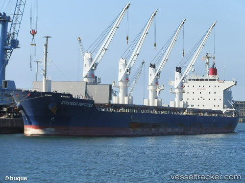
Vessel Strategic Fortitude IMO: 9753387, MMSI: 566646000 Bulk Carrier
UTC, 33.79833, 130.99333, course: -1, speed: 0
UTC, 33.79833, 130.99333, course: -1, speed: 0
2026-03-02 03:18:41 UTC, 33.79833, 130.99333, course: -1, speed: 0
Live AIS position:
UTC. Near KANDA),
updated 2026-03-02 03:18:41 UTC.
Find the position of the vessel Strategic Fortitude on the map. The latter are known coordinates and path.
marine traffic ship tracker show on live map
The current position of vessel Strategic Fortitude is 33.79833 lat / 130.99333 lng. Updated: 2026-03-02 03:18:41 UTCDetails:
Last coordinates of the vessel:
UTC, 33.79833, 130.99333, course: -1, speed: 0UTC, 33.79833, 130.99333, course: -1, speed: 0
UTC, 33.79833, 130.99333, course: -1, speed: 0
2026-03-02 03:18:41 UTC, 33.79833, 130.99333, course: -1, speed: 0