 vesseltracker.com
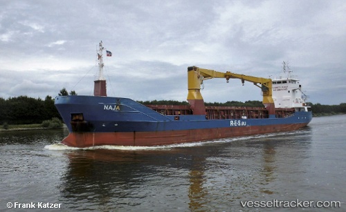
Vessel ANKA SKY IMO: 9145126, MMSI: 577474000 General Cargo Ship
UTC, 44.72709, 37.77492, course: 243, speed: 14.8
UTC, 44.72709, 37.77492, course: 243, speed: 14.8
2026-03-03 17:58:17 UTC, 44.72709, 37.77492, course: 243, speed: 14.8
Live Vessel ANKA SKY Analytics (details, animations, etc.)
Live AIS position: UTC. Near Novorossiysk), updated 2026-03-03 17:58:17 UTC.Find the position of the vessel ANKA SKY on the map. The latter are known coordinates and path.
marine traffic ship tracker show on live map
The current position of vessel ANKA SKY is 44.72709 lat / 37.77492 lng. Updated: 2026-03-03 17:58:17 UTCCurrently sailing under the flag of Vanuatu
ANKA SKY built in 1997 year
Deadweight:
3526 tDetails:
Last coordinates of the vessel:
UTC, 44.72709, 37.77492, course: 243, speed: 14.8UTC, 44.72709, 37.77492, course: 243, speed: 14.8
UTC, 44.72709, 37.77492, course: 243, speed: 14.8
2026-03-03 17:58:17 UTC, 44.72709, 37.77492, course: 243, speed: 14.8