 vesseltracker.com
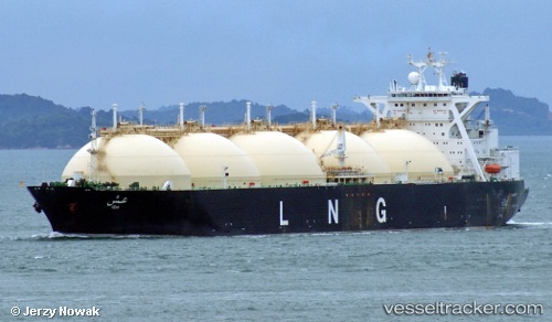
 Ish
Ish
Current Status
Where is the vessel?
Ish is currently in Near Lobo, based on AIS data received about 18h ago.
Latest AIS update:
Current position: 13.62012° N, 121.08265° E (Near Lobo)
Average speed (last 7 days): Loading…
Average speed (last 30 days): Loading…
Vessel profile: Ish is a Lng Tanker with dimensions 294m x 46m.
This page combines live AIS, route history, probable destination signals, nearby traffic, and port activity for practical vessel monitoring.
The current position of vessel Ish is 13.62012 lat / 121.08265 lng. Updated: 2026-04-10 07:39:53 UTCNearest reference points:
- Near Lobo
- 12 nm S of Lobo
- Near Nasugbu, Luzon
Currently sailing under the flag of Liberia ![]()
Ish built in 1995 year
Deadweight:
71931 tDetails:
Live Vessel Ish Analytics (details, animations, etc.)
Recent AIS points (UTC):
2026-04-10 01:43:07 UTC · 13.62016, 121.08264 · SOG 0 kn · COG 70°2026-04-10 03:57:47 UTC · 13.62014, 121.08265 · SOG 0 kn · COG 70°
2026-04-10 05:33:50 UTC · 13.62012, 121.08267 · SOG 0 kn · COG 70°
2026-04-10 07:39:53 UTC · 13.62012, 121.08265 · SOG 0 kn · COG 70°