 vesseltracker.com
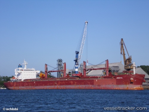
Vessel Anarita IMO: 9636008, MMSI: 636015345 Bulk Carrier
UTC, 28.08766, -15.38893, course: 357, speed: 0
UTC, 28.08763, -15.38876, course: 358, speed: 0.1
2026-01-16 08:05:41 UTC, 28.08783, -15.38936, course: 14, speed: 0.1
Live AIS position:
UTC. Near Las Palmas de Gran Canaria),
updated 2026-01-16 08:05:41 UTC.
Find the position of the vessel Anarita on the map. The latter are known coordinates and path.
marine traffic ship tracker show on live map
The current position of vessel Anarita is 28.08783 lat / -15.38936 lng. Updated: 2026-01-16 08:05:41 UTCCurrently sailing under the flag of Liberia
Anarita built in 2012 year
Deadweight:
58018 tDetails:
Last coordinates of the vessel:
UTC, 28.08786, -15.38967, course: 22, speed: 0.1UTC, 28.08766, -15.38893, course: 357, speed: 0
UTC, 28.08763, -15.38876, course: 358, speed: 0.1
2026-01-16 08:05:41 UTC, 28.08783, -15.38936, course: 14, speed: 0.1