 vesseltracker.com
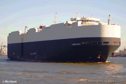
 Lake Kivu
Current Status
Where is the vessel?
Lake Kivu is currently in Near GREAT YARMOUTH, based on AIS data received less than 1h ago.
Latest AIS update:
Current position: 52.57832° N, 1.73892° E (Near GREAT YARMOUTH)
Average speed (last 7 days): Loading…
Average speed (last 30 days): Loading…
Vessel profile: Lake Kivu is a Vehicles Carrier with dimensions 182m x 32m.
This page combines live AIS, route history, probable destination signals, nearby traffic, and port activity for practical vessel monitoring.
The current position of vessel Lake Kivu is 52.57832 lat / 1.73892 lng. Updated: 2026-04-02 19:44:49 UTCNearest reference points:
- Near Oulton Broad
- Near Hemsby
- Near Hedenham
Currently sailing under the flag of Liberia ![]()
Lake Kivu built in 2006 year
Deadweight:
12322 tDetails:
Live Vessel Lake Kivu Analytics (details, animations, etc.)
Recent AIS points (UTC):
2026-04-02 13:56:24 UTC · 52.57810, 1.73890 · SOG 0.2 kn · COG 181°2026-04-02 15:26:23 UTC · 52.57827, 1.73893 · SOG 0 kn · COG 181°
2026-04-02 18:20:22 UTC · 52.57828, 1.73895 · SOG 0 kn · COG 181°
2026-04-02 19:44:49 UTC · 52.57832, 1.73892 · SOG 0 kn · COG 182°