 vesseltracker.com
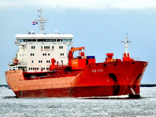
Vessel Mt Chem Alya IMO: 9486166, MMSI: 636017886 Chemical Oil Products Tanker
UTC, 1.32326, 104.16234, course: 90, speed: 0
UTC, 1.32333, 104.16240, course: 90, speed: 0
2026-01-29 08:12:26 UTC, 1.32333, 104.16236, course: 90, speed: 0
Live AIS position:
UTC. Near PENGERANG),
updated 2026-01-29 08:12:26 UTC.
Find the position of the vessel Mt Chem Alya on the map. The latter are known coordinates and path.
marine traffic ship tracker show on live map
The current position of vessel Mt Chem Alya is 1.32333 lat / 104.16236 lng. Updated: 2026-01-29 08:12:26 UTCDetails:
Last coordinates of the vessel:
UTC, 1.32167, 104.16167, course: -1, speed: 0UTC, 1.32326, 104.16234, course: 90, speed: 0
UTC, 1.32333, 104.16240, course: 90, speed: 0
2026-01-29 08:12:26 UTC, 1.32333, 104.16236, course: 90, speed: 0