 vesseltracker.com
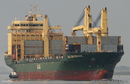
Vessel Aal Brisbane IMO: 9498341, MMSI: 636018135 Multi Purpose Carrier
UTC, 31.59822, 121.31021, course: 327, speed: 0.1
UTC, 31.60034, 121.30693, course: 122, speed: 0.1
2026-03-24 08:21:00 UTC, 31.59996, 121.30668, course: 102, speed: 0
Live Vessel Aal Brisbane Analytics (details, animations, etc.)
Live AIS position: UTC. Near Chongming), updated 2026-03-24 08:21:00 UTC.Find the position of the vessel Aal Brisbane on the map. The latter are known coordinates and path.
marine traffic ship tracker show on live map
The current position of vessel Aal Brisbane is 31.59996 lat / 121.30668 lng. Updated: 2026-03-24 08:21:00 UTCCurrently sailing under the flag of Liberia
Aal Brisbane built in 2010 year
Deadweight:
32312 tDetails:
Last coordinates of the vessel:
UTC, 31.59817, 121.31027, course: 327, speed: 0.1UTC, 31.59822, 121.31021, course: 327, speed: 0.1
UTC, 31.60034, 121.30693, course: 122, speed: 0.1
2026-03-24 08:21:00 UTC, 31.59996, 121.30668, course: 102, speed: 0