 vesseltracker.com
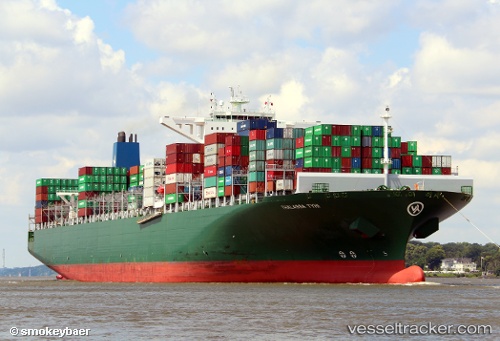
 Thalassa Tyhi
Current Status
Where is the vessel?
Thalassa Tyhi is currently in 14 nm S of Eastbourne, based on AIS data received about 1h ago.
Latest AIS update:
Current position: 50.53134° N, 0.30016° E (14 nm S of Eastbourne)
Average speed (last 7 days): Loading…
Average speed (last 30 days): Loading…
Vessel profile: Thalassa Tyhi is a Container Ship with dimensions 368m x 51m.
This page combines live AIS, route history, probable destination signals, nearby traffic, and port activity for practical vessel monitoring.
The current position of vessel Thalassa Tyhi is 50.53134 lat / 0.30016 lng. Updated: 2026-04-05 09:44:21 UTCNearest reference points:
- 23 nm S of Poling
- 27 nm S of Seaford
- Near Saint Leonards-on-Sea
Currently sailing under the flag of Liberia ![]()
Thalassa Tyhi built in 2014 year
Deadweight:
131862 tDetails:
Live Vessel Thalassa Tyhi Analytics (details, animations, etc.)
Recent AIS points (UTC):
2026-04-05 04:01:23 UTC · 51.53687, 1.77629 · SOG 13.1 kn · COG 182°2026-04-05 06:26:03 UTC · 51.05392, 1.44542 · SOG 15.9 kn · COG 236°
2026-04-05 08:08:35 UTC · 50.74201, 0.85278 · SOG 16.8 kn · COG 231°
2026-04-05 09:44:21 UTC · 50.53134, 0.30016 · SOG 14.3 kn · COG 253°