 vesseltracker.com
 Adamar
Current Status
Where is the vessel?
Adamar is currently in 22 nm W of Finisterre, based on AIS data received less than 1h ago.
Latest AIS update:
Current position: 42.90100° N, 9.76454° W (22 nm W of Finisterre)
Average speed (last 7 days): Loading…
Average speed (last 30 days): Loading…
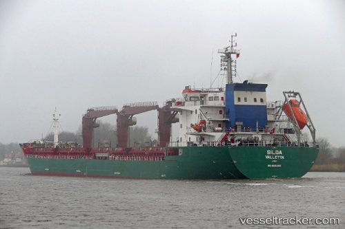
Vessel profile: Adamar is a General Cargo Ship with dimensions 147m x 23m.
This page combines live AIS, route history, probable destination signals, nearby traffic, and port activity for practical vessel monitoring.
The current position of vessel Adamar is 42.90100 lat / -9.76454 lng. Updated: 2026-04-10 04:21:57 UTCNearest reference points:
- Near Portosin
- 40 nm NW of Sarinena
- 13 nm NE of Villanueva de Lorenzana
Currently sailing under the flag of Liberia ![]()
Adamar built in 2009 year
Deadweight:
16622 tDetails:
Live Vessel Adamar Analytics (details, animations, etc.)
Recent AIS points (UTC):
2026-04-09 21:23:22 UTC · 41.90500, -9.76500 · SOG 8 kn · COG -1°2026-04-10 00:31:08 UTC · 42.33763, -9.75915 · SOG 9.2 kn · COG 3°
2026-04-10 02:37:56 UTC · 42.65338, -9.75951 · SOG 8.9 kn · COG 0°
2026-04-10 04:21:57 UTC · 42.90100, -9.76454 · SOG 8.8 kn · COG 358°