 vesseltracker.com
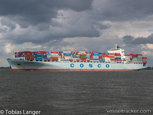
Vessel GSL KALLIOPI IMO: 9285689, MMSI: 636019536 Container Ship
UTC, 54.28916, -130.36069, course: 184, speed: 0
UTC, 54.28915, -130.36069, course: 185, speed: 0
2026-02-26 06:20:04 UTC, 54.28914, -130.36064, course: 184, speed: 0
Live AIS position:
UTC. Near Prince Rupert),
updated 2026-02-26 06:20:04 UTC.
Find the position of the vessel GSL KALLIOPI on the map. The latter are known coordinates and path.
marine traffic ship tracker show on live map
The current position of vessel GSL KALLIOPI is 54.28914 lat / -130.36064 lng. Updated: 2026-02-26 06:20:04 UTCCurrently sailing under the flag of Liberia
GSL KALLIOPI built in 2004 year
Deadweight:
99066 tDetails:
Last coordinates of the vessel:
UTC, 54.28918, -130.36069, course: 184, speed: 0UTC, 54.28916, -130.36069, course: 184, speed: 0
UTC, 54.28915, -130.36069, course: 185, speed: 0
2026-02-26 06:20:04 UTC, 54.28914, -130.36064, course: 184, speed: 0