 vesseltracker.com
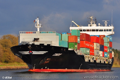
 TUNADAL
Current Status
Where is the vessel?
TUNADAL is currently in Near ROTTERDAM PERNIS, based on AIS data received about 1h ago.
Latest AIS update:
Current position: 51.87975° N, 4.39837° E (Near ROTTERDAM PERNIS)
Average speed (last 7 days): Loading…
Average speed (last 30 days): Loading…
Vessel profile: TUNADAL is a Container Ship with dimensions 158m x 158m.
This page combines live AIS, route history, probable destination signals, nearby traffic, and port activity for practical vessel monitoring.
The current position of vessel TUNADAL is 51.87975 lat / 4.39837 lng. Updated: 2026-04-08 16:11:53 UTCNearest reference points:
- Near ROTTERDAM PERNIS
- Near Heijplaat
- Near ROTTERDAM WAALHAVEN
Currently sailing under the flag of Liberia ![]()
TUNADAL built in 2012 year
Deadweight:
14740 tDetails:
Live Vessel TUNADAL Analytics (details, animations, etc.)
Recent AIS points (UTC):
2026-04-08 09:58:00 UTC · 51.89086, 4.40147 · SOG 5.2 kn · COG 155°2026-04-08 11:56:53 UTC · 51.87975, 4.39835 · SOG 0 kn · COG 82°
2026-04-08 13:59:52 UTC · 51.87976, 4.39837 · SOG 0 kn · COG 82°
2026-04-08 16:11:53 UTC · 51.87975, 4.39837 · SOG 0 kn · COG 82°