 vesseltracker.com
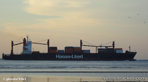
Vessel MIRADOR EXPRESS IMO: 9243174, MMSI: 636020941 Container Ship
UTC, -33.91440, 18.43226, course: 312, speed: 0
UTC, -33.91441, 18.43232, course: 312, speed: 0
2026-02-21 12:00:36 UTC, -33.91437, 18.43234, course: 312, speed: 0
Live AIS position:
UTC. Near Cape Town),
updated 2026-02-21 12:00:36 UTC.
Find the position of the vessel MIRADOR EXPRESS on the map. The latter are known coordinates and path.
marine traffic ship tracker show on live map
The current position of vessel MIRADOR EXPRESS is -33.91437 lat / 18.43234 lng. Updated: 2026-02-21 12:00:36 UTCCurrently sailing under the flag of Liberia
MIRADOR EXPRESS built in 2002 year
Deadweight:
40478 tDetails:
Last coordinates of the vessel:
UTC, -33.91440, 18.43229, course: 312, speed: 0UTC, -33.91440, 18.43226, course: 312, speed: 0
UTC, -33.91441, 18.43232, course: 312, speed: 0
2026-02-21 12:00:36 UTC, -33.91437, 18.43234, course: 312, speed: 0