 vesseltracker.com
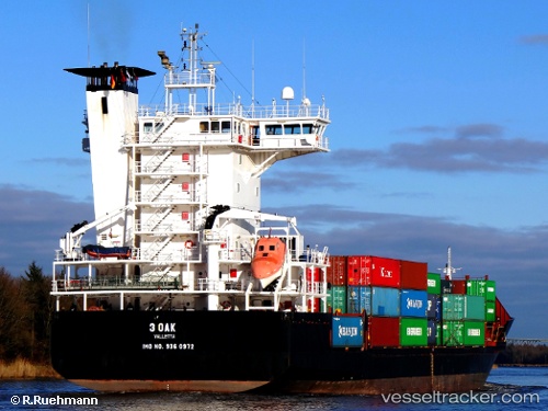
Vessel ADMIRAL STAR IMO: 9360972, MMSI: 636021459 Container Ship
UTC, 31.77633, 34.55633, course: 35, speed: 0.1
UTC, 31.77633, 34.55600, course: 38, speed: 0.1
2026-01-19 23:44:21 UTC, 31.77650, 34.55600, course: 41, speed: 0.1
Live AIS position:
UTC. Near Zikim),
updated 2026-01-19 23:44:21 UTC.
Find the position of the vessel ADMIRAL STAR on the map. The latter are known coordinates and path.
marine traffic ship tracker show on live map
The current position of vessel ADMIRAL STAR is 31.77650 lat / 34.55600 lng. Updated: 2026-01-19 23:44:21 UTCCurrently sailing under the flag of Liberia
ADMIRAL STAR built in 2006 year
Deadweight:
8694 tDetails:
Last coordinates of the vessel:
UTC, 31.77633, 34.55617, course: 37, speed: 0.1UTC, 31.77633, 34.55633, course: 35, speed: 0.1
UTC, 31.77633, 34.55600, course: 38, speed: 0.1
2026-01-19 23:44:21 UTC, 31.77650, 34.55600, course: 41, speed: 0.1