 vesseltracker.com
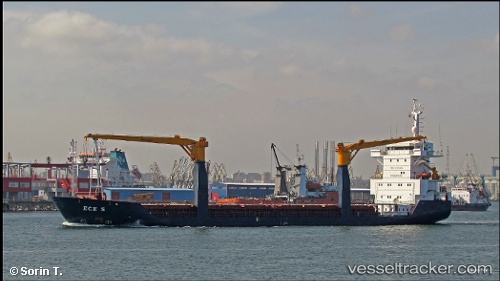
Vessel ECE S IMO: 9183489, MMSI: 636021694 General Cargo Ship
UTC, 32.85439, 34.99726, course: 277, speed: 0.4
UTC, 32.85429, 34.99721, course: 282, speed: 0.3
2026-01-29 05:42:48 UTC, 32.85441, 34.99726, course: 280, speed: 0.2
Live AIS position:
UTC. Near Haifa),
updated 2026-01-29 05:42:48 UTC.
Find the position of the vessel ECE S on the map. The latter are known coordinates and path.
marine traffic ship tracker show on live map
The current position of vessel ECE S is 32.85441 lat / 34.99726 lng. Updated: 2026-01-29 05:42:48 UTCCurrently sailing under the flag of Liberia
ECE S built in 1998 year
Deadweight:
5774 tDetails:
Last coordinates of the vessel:
UTC, 32.85439, 34.99723, course: 280, speed: 0.3UTC, 32.85439, 34.99726, course: 277, speed: 0.4
UTC, 32.85429, 34.99721, course: 282, speed: 0.3
2026-01-29 05:42:48 UTC, 32.85441, 34.99726, course: 280, speed: 0.2