 vesseltracker.com
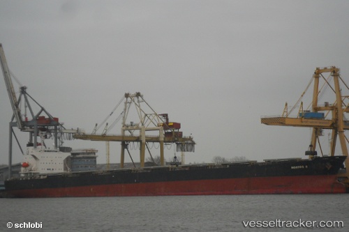
 PANAMAX NOSTOS
Current Status
Where is the vessel?
PANAMAX NOSTOS is currently in 29 nm SE of Boboras, based on AIS data received about 1h ago.
Latest AIS update:
Current position: 46.06190° N, 7.69537° W (29 nm SE of Boboras)
Average speed (last 7 days): Loading…
Average speed (last 30 days): Loading…
Vessel profile: PANAMAX NOSTOS is a Bulk Carrier with dimensions m x m.
This page combines live AIS, route history, probable destination signals, nearby traffic, and port activity for practical vessel monitoring.
The current position of vessel PANAMAX NOSTOS is 46.06190 lat / -7.69537 lng. Updated: 2026-03-28 19:45:01 UTCNearest reference points:
- 57 nm S of Boboras
- 58 nm SE of Rietheim-Weilheim
- 60 nm SE of San Clodio
Currently sailing under the flag of Liberia ![]()
Details:
Live Vessel PANAMAX NOSTOS Analytics (details, animations, etc.)
Recent AIS points (UTC):
2026-03-28 13:58:01 UTC · 45.05405, -8.48043 · SOG 11.3 kn · COG -1°2026-03-28 15:38:10 UTC · 45.33398, -8.27720 · SOG 11.8 kn · COG -1°
2026-03-28 15:38:10 UTC · 45.33398, -8.27720 · SOG 11.8 kn · COG -1°
2026-03-28 19:45:01 UTC · 46.06190, -7.69537 · SOG 11.8 kn · COG -1°