 vesseltracker.com
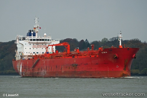
 STAR C
Current Status
Where is the vessel?
STAR C is currently in Near SARROCH, based on AIS data received about 16h ago.
Latest AIS update:
Current position: 39.08567° N, 9.03651° E (Near SARROCH)
Average speed (last 7 days): Loading…
Average speed (last 30 days): Loading…
Vessel profile: STAR C is a Chemical Oil Products Tanker with dimensions 184m x 27m.
This page combines live AIS, route history, probable destination signals, nearby traffic, and port activity for practical vessel monitoring.
The current position of vessel STAR C is 39.08567 lat / 9.03651 lng. Updated: 2026-04-10 07:20:50 UTCNearest reference points:
- Near SARROCH
- Near Cagliari
- Near CARLOFORTE
Currently sailing under the flag of Liberia ![]()
STAR C built in 2009 year
Deadweight:
37836 tDetails:
Live Vessel STAR C Analytics (details, animations, etc.)
Recent AIS points (UTC):
2026-04-10 02:26:47 UTC · 39.08568, 9.03646 · SOG 0 kn · COG 137°2026-04-10 03:47:51 UTC · 39.08566, 9.03650 · SOG 0 kn · COG 137°
2026-04-10 05:59:48 UTC · 39.08572, 9.03641 · SOG 0 kn · COG 137°
2026-04-10 07:20:50 UTC · 39.08567, 9.03651 · SOG 0 kn · COG 137°