 vesseltracker.com
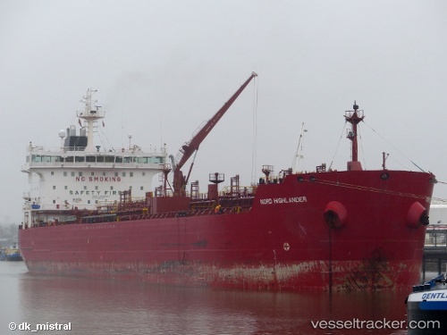
Vessel The Loop IMO: 9334789, MMSI: 636022668 Chemical Tanker
UTC, 40.95833, 28.73333, course: -1, speed: 0
UTC, 40.95944, 28.73414, course: 258, speed: 0
2026-01-28 01:51:25 UTC, 40.88252, 28.57171, course: 257, speed: 12
Live AIS position:
UTC. Near Yakuplu),
updated 2026-01-28 01:51:25 UTC.
Find the position of the vessel The Loop on the map. The latter are known coordinates and path.
marine traffic ship tracker show on live map
The current position of vessel The Loop is 40.88252 lat / 28.57171 lng. Updated: 2026-01-28 01:51:25 UTCCurrently sailing under the flag of Liberia
The Loop built in 2007 year
Deadweight:
37145 tDetails:
Last coordinates of the vessel:
UTC, 40.95970, 28.73396, course: 247, speed: 0UTC, 40.95833, 28.73333, course: -1, speed: 0
UTC, 40.95944, 28.73414, course: 258, speed: 0
2026-01-28 01:51:25 UTC, 40.88252, 28.57171, course: 257, speed: 12